Blog Post

Bloomfield Covered Bridge Ride

Another hot day and another long ride. Leader Stan Ellis had checked with the Green County Highway Department and found that paving had been completed in the Bloomfield area. So, except for the infamous Rock East we had quite a bit of good to excellent to brand new pavement. This is a difficult ride, but all agree it’s not as difficult as last week’s Williams Covered Bridge Ride.

We started with 16 riders and picked up another couple on the way out of town. Most did the whole ride but a few did judiciously opt for the 50 mile short option. The morning ride was a delight. Everyone in the main group made the trek out to the covered bridge before our lunch stop. (Thanks to John Bassett for taking this photo on CE Taylor’s smartphone.)

If you look closely at the right you’ll see CE and me, each sporting CamelPaks. This was my first time trying one. It worked out pretty well. I was able to stay much better hydrated and the back pack was not too hot or uncomfortable. I emptied two water bottles of Gatorade and one 70 oz CamelPak before our lunch stop at the Bloomfield Subway. Most of us had sandwiches and drinks there and were able to put ice and Powerade in our bottles.

After lunch we headed out on the return half of the ride. We followed up with stops in Springville and Harrodsburg. We were split into two groups, not too far apart and both groups generally tried to keep the pace down as the afternoon heat increased.

There were no mechanical problems beyond several dropped chains on hills. Everone managed the heat in his or her own way. Overall it was a good ride on a hot summer day.

Hot Double Century

The club already received a succinct report on this year’s double century from participant Rudy Savich: “Hot!” Here the ride organizer, Jim Schroeder provides a more detailed report.

This was the 13th year that there has been a double century in Bloomington for the BBC.  The first eleven years it was known as Rudy’s Double Century as Rudy Savich organized, mapped out the route, and provided support for the riders.  He also selected a charity that would benefit from any donations that any rider would have liked to make to that cause.  Last year did not have Rudy or a charitable cause as six BBC members rode to Paris, IL with the sag support of Eugene Kase.

This year I decided to resurrect the charity angle as the 2012 Tornado Double Century went to the Henryville, Indiana area where tornadoes ravaged that area this past March.  Many of us have ridden southern Indiana, and I thought it would be fitting for mostly fortunate Bloomington to give something back.  A local charity, HCC Recovery, was selected and several BBC members and a few Jim’s CVS customers contributed to the cause.

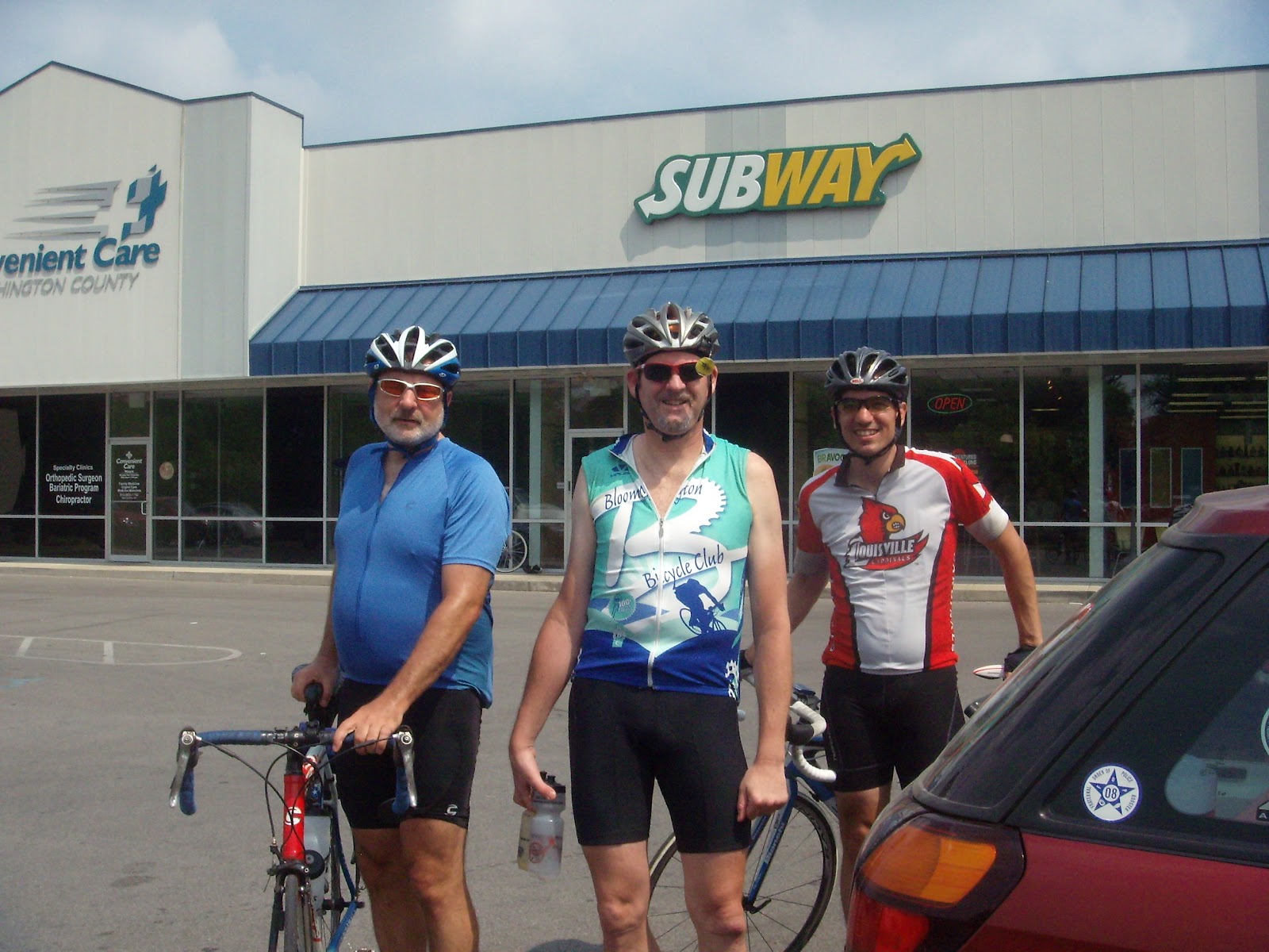
6am at Bryan Park, three riders and a sag support driver started the journey.  I had tried to publicize this event and promote a “share a century” concept where riders could ride the first 100 miles and then help support the riders that were riding the last 100 miles.  That was not the case, and so, Sylvia Stoub drove the famous support Subaru with 3 “tifosi” golden retrievers while Nathan Rogers, Rudy Savich, and myself headed off on our two-wheeled steads.

Nathan had never attempted a double century and thought it would be a good test for his first RAIN ride a month later.  Rudy, mostly a marathon runner, decided to strart training  for this two WEEKS previous.  I had planned a grueling 200 miler with a “hill mongerish” 9,600 feet of climbing, but not the mid-90 degree heat in store for us!

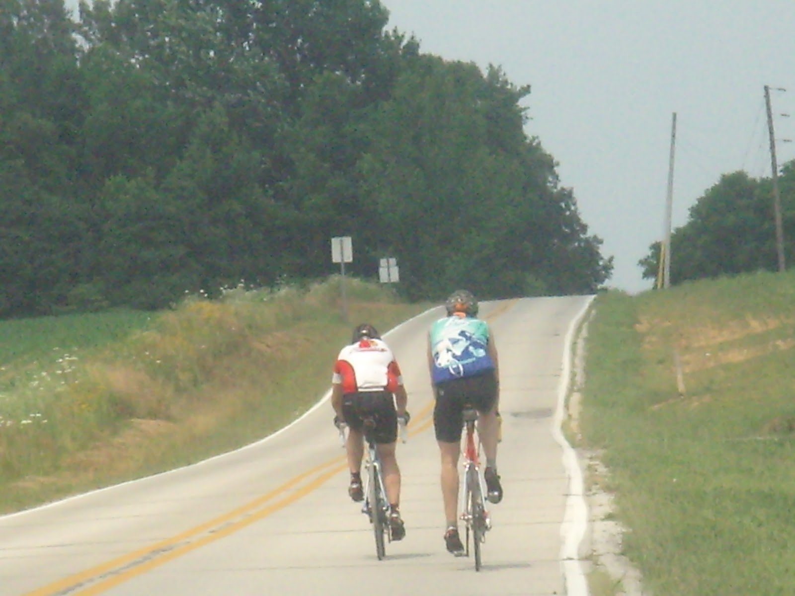
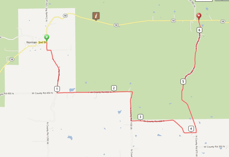
We started the route with some familiarity as we paced down to Springville and Fayetteville, and then turned left on IN-150 through Eureka and then Bedford, which was actually new to Rudy.  The dogs kept us alert, as Gracie barked at every farm animal she saw.

Rolling to hilly but always enjoyable Tunnelton Rd was ridden, naturally, all the way to Tunnelton on the East Fork of the White River, as we now entered BBC uncharted lands through Bono and Cave River Valley, and highway 60 to Salem.  The country roads were some of the best I’ve encountered, and IN-60 had a nice shoulder.  70 miles showed on the computer so we decided to eat at a Subway south of the courthouse in Salem.

We veered onto a nice country up an downer, Martinsburg Rd, which ran parallel to IN-60, but the scenery was nice and the tree cover cooled our bodies.  We came back on IN-60 in Pekin, but that was okay as the state road avoid all the “knobs” that surrounded us on both sides of the highway.  After passing over I-65 we then headed north on US-31 and entered Henryville and stopped at Henryville Christian Church to hand over our donations of about $1500.  There was so much going on with all the construction of the school and many houses in town.  The Church was the mess hall for all the volunteers out there.  The kids enjoyed the dogs, while we enjoyed ice cream sundaes.  There was so much donated food that they even gave us boxes and boxes of Clif bars. Behind them, I understood the gesture: There was a 10 ft x 10ft x 10ft cubicle mountain of just Cliff bars!

At this 100 mile point, Rudy was tiring of all the hills dolled out on him, so we suggested that he ride on the flatter US-31 to Austin and Crothersville, while the rest of us went farther east and north to Marysville and Lexington.  There we followed the path of destruction on Henryville-Otisco Rd.  The heat and the country hills were pounding us, but nothing like the tornado that had pounded on the forests, houses, and churches throughout the countryside.

Nathan and I had hoped to meet up with Rudy somewhere between Austin and Crothersville.  Rudy even left us a sign, a red rag on a street sign but we missed it in Crothersville.  All of our cell phones had lost power by then, so there was no way to find him.  Brownstown was our last stop, and some remnants of some rain storms cooled the road off a bit as we now headed north on IN-135.  We even had one of those rain showers in the sun later, and that sure felt good.  We took the detour around the Kurtz bridgework, but we went the opposite way that the Nashville 90’rs went.  We had all the uphill!  Arrggh!

Finally, our last leg was IN-446, and it was quite desolate until we climbed Mellencamp Hill just north of the causeway.  Traffic piled up behind our sag vehicle and it was getting darker by the minute.  We still hadn’t seen Rudy, so I decided that we should turn right at the Cabin Restaurant and go to Rudy’s house to check on the situation. Rudy was actually ten to fifteen minutes ahead of us.  By then it was pitch dark.  I figured that 191 miles was long enough for a double century, so we all loaded up in the Subaru and dropped off Nathan.

-From Jim Schroeder

This was my first time to ride the Nashville 90. …

This was my first time to ride the Nashville 90. It was a great ride. OK, so I was the chief mutineer on the way home but I think deep down, everyone was grateful that I stuck to my guns and said I was heading straight home. I had done the math and I was on course for a full century and didn't need that many extra miles.

I drank water all day but should have drunk twice as much. I am sure you can drink to much on a hot day but that would be better than too little.

It was good to get water at the church on Tunnel Road and see fellow club members cooling off. Thanks to Allan for watching out for us rookies on the Nashville 90.

Venice Traverse

Tuesday marked the OWLS switching their start place from Sherwood Oaks Church to Bryan Park, like everyone else. The closures of the intersection of Sare and Rogers and of Harrell finally pushed us into it. For now we are experimenting with a 6 pm start so we stay a little bit separated from the other groups starting at 5:45. But we may go back to 5:45 if that’s what people prefer.

We did a short ride north to mark the new start site, a simple 22  mile loop out and back on Bottom Road with a loop on Simpson Chapel and Lawson at the north end. Altogether we had 12 riders out for a gorgeous cool June evening.

The plan was to take in the Astronomy Open House on the top deck of the Henderson-Atwater Parking garage viewing the traverse of Venice across the sun. They were set up with filtered telescopes. But there was a huge crowd and none of us wanted to wait in line. I did take in club member John Carini’s scope projection on a white board. The sun projected to a 4 inch disc and the small black dot corresponding to Venice was clearly visible.

Riding up and down the parking structure ramps on our bicycles was a blast. The Garmin GPS hardly knew what to make of it:

Columbus Century

It was another perfect day for another great midweek century. This time our leader Jim S had a route starting from Bryan Park and visiting downtown Columbus, which he christened “Columbus Day”. The first and last legs–Bloomington to Nashville and Gatesville to Bloomington–were quite familiar. The middle part looping out to Columbus was much less familiar and totally new to me on a bike.

The weather was a bit cool, in the 50s for our 8 am start. But I was the only one wearing a vest and sleeves. I was happy to have them. But I removed the vest in Nashville and the sleeves in Columbus and had to carry them the rest of the way.

We had a great group of riders, at eight this was probably the biggest group of the season so far. Of these Brad was new to the club. For Clair and Laurence it was their first century of the season. The group was rounded out with Klaus, Allan, Tammy, and Dana.

We all stopped at roughly 25 mile intervals: snacks at the service station in Nashville, a sit-down lunch at Papa’s Deli on Washington Street in downtown Columbus, and snacks and drinks again at the store in Gatesville.

Here are Dana, Brad, Laurence, and Tammy raring to get going again in Nashville (while Klaus chats on the phone):

The covered patio at Papa’s Downtown Deli, with Tammy, Clair, Klaus, and Dana:

We took the westside “People’s Trail”, a dedicated bike and walking trail, from the outskirts of Columbus to near downtown, passing north of the motels, gas stations, and fast food along 46, through a tunnel under I-65 and a ramp, across the bridge (completely separated from car traffic), to near downtown.

At Papa’s Deli we were able to order sandwiches and eat outside on their covered patio facing Washington Street. I had been dreaming of a ham and cheese sandwich on rye. But when I saw that their menu including vegetarian options I settled for the vegetarian delight cheese sandwich on a croissant.

Our lead group was going quite a bit faster than some of the rest of us. They did wait for us at the first two stops. After lunch we started together but gradually fell into two groups. Those of us in the slower group opted to take Klaus’s short cut that supposedly saved about 4 miles including the 2 miles where the route dropped down to go along Highway 46. The trade-off was that the short cut involved a mile of gravel down a steep hill. We had dreams of getting to the store in Gatesville before the lead group. We were sorely disappointed to find them already there and, indeed, ready to take off. With that Tammy, Laurence, and Dana took off and were never seen again. Tammy reported back later by email that they didn’t stop again, and arrived back at Bryan Park about 3:20 having averaged 16.9 for the day! I’m assuming they did the entire route as mapped. I tried unsuccessfully to come up with a good name for them, the “Iron Ladies”?

The rest of us took a break on the front porch. Here are Jim and Klaus on the porch:

Before leaving the thriving metropolis of Gatesville I paused briefly to take a picture of their iconic sign. I’ve been meaning to do that for years.

Brad headed off from Gatesville on his own. Pretty soon Jim left Klaus, Clair and me to take care of ourselves. It didn’t take much convincing for us to follow Klaus’s suggestion of a stop at the Port Hole, where we had a round of cokes before heading home.

I suppose we deserve a name, too. Again I’m not too good with names, but “Lazy Dogs” wouldn’t be too far off. We tried to enjoy ourselves at least. Klaus opted for Shuffle Creek, while Clair and I took Tunnel and went back on 45. That was good enough for me since the mile each way from home to Bryan Park put me just over 100, with an average of 14.1 for the day.

Nashville 90 Detour

By Mike Finger
BBC Ride Director

For those of you who like to do the Nashville 90, you have probably heard by now that Hwy 58 is closed for bridge repair between Norman and Kurtz. The duration of this closure is predicted to last several months, meaning it will affect us most of the summer. I have ridden the 90 twice since the road was closed, and have been able to climb over and around the obstacles that are in the road both times. This makes the ride do-able, but hardly suffices as BBC policy for a club sanctioned ride.

There is a county road detour of modest length. When you come to the T on 58 at Norman do not take the left that would keep you on 58, but instead go to the right. The road sign there identifies this as 1250W. Take this road .9 miles to a left onto W450. At some point W450 morphs into 1100W. I never saw a sign for this change but immediately after going past a weird combination log cabin/barn type structure (on your left) the road takes a hard right presumably onto 1100W. After being on W450/1100W for 1.8 miles you will come to your next turn onto 400N, to the left. Follow this 1.8 miles to another left onto 975W. Stay on 975W all the way back to Hwy 58 (2miles). It comes out at the crest of the hill just past the bridge closure. Take a right there and you’re back on route to Freetown.

Link to map at RideWithGPS.com.

The total detour is only 6.5 miles, and you’ve cut out several miles of Hwy 58, which means it will only add a couple of miles to your day’s total. The road quality varies between ‘not great’ and ‘excellent’. There are a few broken up spots on 400N, and the last mile plus on 975W is new pavement. There are a few hills.

Bon appetit!!

Memorial Day Breakfast Ride

By Allan Edmonds

This year has marked a renewed push to augment the regular BBC ride schedule with more social activities. Today’s Memorial Day Breakfast Ride was one of those enjoyable events we’ve let slide in recent years. Today we had a total of 22 riders, 16 from Bryan Park and 6 more joining the route as it went by Ellettsville; in addition we had a couple spouses and children join us by car for breakfast at the Canyon Inn at McCormick’s Creek State Park. After a double check we called the dining room at the Inn to let them know we were coming.
In the days leading up to the ride we fielded various email and phone inquiries, encouraging everyone to come out. We had a really eclectic group, as desired, from strong and experienced riders to a few for whom this was their first club ride.
Our group got to the park just after 9:30, with 18.5 miles on our computers. Once there we had a leisurely breakfast at the all-you-can-eat buffet bar. Eggs, bacon, sausage, biscuits, gravy, pancakes, french toast. Cereal, fruit, sweet rolls, etc. etc.

After breakfast some riders went with their families. The rest of us took a short loop through the park.  When we left the park, the Ellettsville group headed back the way we had come, while the remaining riders took the planned route down to Whitehall on Highway 43. We regrouped there before heading back via Highway 48 to Vernal Pike, into town, through town on the B-Line Trail. Here’s a snapshot of the route and elevation profile.
The electronic version of the route at RidewithGPS.com is here.
Altogether everyone seemed quite pleased. Even on the ride, not to mention the breakfast, there was time to chat and get to know each other. Yes, it was leisurely. But we got in about 45 miles, and we were home before the heat really set in.

North Carolina Weekend

By John Bassett

I guess you are never too old to do crazy stuff.  So when the opportunity presented itself to join Jim Schroeder and Sylvia Stoub for a weekend bicycle jaunt to North Carolina, I jumped on it.  The primary goal of the trip was an ascent of Mt. Mitchell, North Carolina, which at 6,684 feet elevation is the highest peak east of the Mississippi River.  Starting in Swannanoa, just east of Asheville, Jim’s route involved a 92 mile loop ascending about 5,200 feet to top of mountain.  The route and profile are shown below.

We left Bloomington about 7:30AM on May 18.  A detour on I-75 due to a landslide on Pine Mountain, Tennessee slowed us a little, but we arrived at the campground in Swannanoa in time for a leisurely warm up ride out and back on the Blue Ridge Parkway.  Back at the campground we joined fellow BBC’er Jim Isenberg and his friend Ann for a great North Carolina barbeque dinner.  We spent the night in quaint camping cabins nestled amongst rhododendron and mountain laurel along a rushing mountain stream.

Early Saturday morning we started the mountain assault.  Isenberg and Ann had decided to try the assent from the west starting at the Appalachian Fork Art Center about Mile 86 on the map.  Schroeder and I cycled east generally on, or paralleling, US 70 through Black Mountain to Old Fort where we found a nice hole-in-the-wall breakfast joint.  I tried the liver mush – interesting, but I would not do it again.

Sylvia turned around at Old Fort and headed back west.  Proceeding east from Old Fort we navigated about 2 miles of gravel (this seems to be a theme on some of Jim’s rides) on Old Greenlee Road and at about Mile 26 turned north on NC 80.  There should be a sign that says the fun begin here.  Starting at an elevation 1,260 feet, one slowly climbs 2,100 feet over the next 12 miles to the Blue Ridge Parkway.  This is the route followed by the organized Assault on Mount Mitchell which was to happen the following Monday, May 21.  We saw painted markings on the pavement at this point indicating 74 miles.  So, these Assault dudes who start in Spartanburg, South Carolina have got 74 miles on their legs before they get to the fun stuff.  We allowed that a leisurely ride up the mountain two days before was preferable.

Never think the Blue Ridge Parkway is flat.  It ain’t.  Once on the Parkway at Mile 38 you are faced with another 3,200 feet of up to get to the top of Mt. Mitchell.  The grade is reasonable, but there is a lot of it.  There are an irritating number of Harley Davidsons and enough gnats get plastered to your face to make you unrecognizable to your next of kin.  Speed is not an indicator of progress.  Set your GPS to display elevation.

About Mile 49 we reached the turn off of the Parkway to Mt Mitchell.  The grade steepens.  I was running low on fluids.  But, about a half hour later you enter Mt. Mitchell State Park and enjoy gorgeous views along the crest of the Appalachian Blue Ridge.  Here is Jim at the top.

After a brief rest, Moon Pie, Coke, and other junk we started down.  This is not what you think.  There is still a remarkable amount of uphill to do along the rolling Parkway.  This adds a lot of climb to the total loop.  Finally at Craggy Gardens (Mile 68) we hooked back up with Sylvia and began to descend.  The 14 mile downhill back to US 70 is spectacular, slicing through dark mountain forests and open glade areas, and yes, the occasional tunnel requiring a bike lite.  On the steeper parts you just pretend you are a car and keep up with the traffic.  The Parkway dumps you back on US 70 just east of Asheville.  A little ride east and a nasty final climb gets you back to the Swannanoa campground.  This is a pretty good “almost century”, and a hilly one at that.  Owing to a couple of missed turns and some exploring we finished with 94 miles.  The GPS recorded a total climb for the day in excess of 9,000 feet.

After pizza and beer in Ashville we returned to the campground and compared notes with Jim Isenberg and Ann.  Their route up was our route down.  Their up and back to the top of Mt. Mitchell totaled 65 miles.  I think they both wished they had done the loop having found their ascent not too difficult.
On Sunday, both Jims, Ann, and I did a another Schroeder-designed 55 mile loop called the Hill of Some Concern, with Sylvia providing SAG support.  It features a little climb of the same name (800 feet with, as Ann counted, 18 switchbacks).  This little puppy is intense in spots and you learn to ride the outside of the lane where the grade is not as steep.  There is an interesting sign at the top which I was glad I did not see at the bottom.

The ride finishes with a nice 10 mile downhill back to Lake Luer, NC.  We finished the ride about 3:30 within sight of the spectacular Chimney Rock, now a North Carolina State Park.

After saying our goodbyes to Jim and Ann, and a mandatory ice cream stop up the road we began the long trip back home.  Bicycling stories abounded which made the trip seem shorter.  Still, it was 1:30 AM before we rolled back into my driveway.

Crazy as a weekend 900 mile round trip may seem, this sure was fun.  Thanks to Jim and Sylvia for organizing.  This seems to be becoming an annual club event.  I think I’d do it again.

Midweek Century to Madison and Mt. Eden

We had a great drive-and-ride midweek century this week. No one showed up for the advertised Wednesday event, so it was rescheduled for Thursday, which attracted a group of six riders.

We drove in three cars to Brownstown, where we parked at the local CVS (naturally).

Click this link for the route map. The map doesn’t do the route complete justice. Here’s the elevation chart:

That hole in the hill at mile 45 or so shows the drop going south through Clifty Falls, followed by the climb along Highway 50 toward Hanover. The tower at Mile 95 or so is Rooster Hill. Except for these two somewhat extreme situations the terrain was actually more moderate than much of what we’re used to around Bloomington.
Here’s a photo by Klaus of the rest of our little group taking in the view of the Ohio River and the Clifty Creek coal-fired power plant on the river. There’s Dana, Allan, Mark, Jim, and John.

Overall one could not have asked for a more perfect day. The skies were clear. The temperature maxed out in the upper 60s. We were all happy to have a second layer of one sort or another.

We enjoyed a long lunch break at the Inn at Clifty Falls State Park. We took several other shorter stops at country stores and even one coffee shop.

According to my GPS we did just over 107 miles in just under 7 hours of riding, for an average moving speed of 15.5. Including stops we were out just under 9 hours, so an overall average of about 12 mph. For the first 45 miles we averaged close to 17 mph. According to the GPS I had 3173 feet of climbing and burned 6748 calories.

Here we are at the top of the last big climb up Rooster Hill, looking pretty happy in a snapshot by John:

For three of us this was BY FAR our longest ride of the the year.

A special thanks to Jim Schroeder for organizing this ride, and for keeping any rider who fell a bit behind in his sights and helping to get them back to the group.