Well, probably not – but it was a good one nonetheless! On May 18 we tried something a little different on the Saturday club calendar and did a drive and ride to the Columbus area. The route was published on the Bicycling Magazine website last year and was touted as the best ride in Indiana. Who could not do such a ride!?
I had blindly put the ride on the club calendar in February. Scouting it last month I had found the terrain a little hilly, but the roads and deep forest setting surprising pleasant.
After a brief rendezvous at Bryan Park to pick up a guest, Greg, from South Bend, Stan and I headed off to the designated starting point at the Jay C on the west side of Columbus. By the 10:00 start time we had, by my count, 21 riders assembled BBC riders. The official route was 56 miles with a 38 mile short option; all elected to go long.
The route starts with a long, gradual climb up the geologic Knobstone Escarpment on West Georgetown Road. Turning south, you descend, cross SR 46, and climb again on Four Mile Ridge Road. Valley Branch Road presents one stout climb and a nice downhill run before you junction with SR 135 just outside of Stone Head. This is a pleasant section that extends on east along Bellsville Pike to Pike’s Peak. Arriving in Pike’s Peak we were surprised to run into Klaus who had ridden his own route from Bloomington. I was also surprised to see a bicycle aid station passing out bananas and cookies. This, we found out, was associated with a separate bicycle tour being run at the same time by the Columbus club – friendly folks, but alas – no cookies for the BBC.
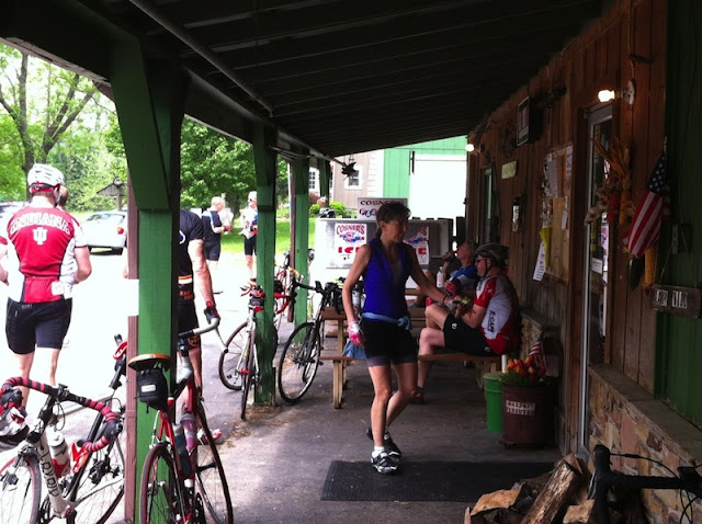
Crouch’s Market in Pike’s Peak is the only good place to refuel. But, by riding a figure-of-eight, with Crouch’s in the middle, the ride has rest stops at 19 and 38 miles which divides the ride into three, about equal, parts. The stops conveniently come after a couple of the more strenuous hilly stretches of the trip, Valley Branch Road headed south to Pike’s Peak on the north loop, and Christianburg Road heading north to Pike’s Peak on south loop. Crouch’s, I must add, makes great sandwiches. I had one at 19 miles, and it was so good I stopped for the “chicken salad special” at 38 miles. Be sure to ask the nice lady at the cash register how Pike’s Peak – located in a valley – got its name.
Leaving Pikes Peak, the south loop of the Figure-of-Eight extends down Poplar Grove Road with yet another steep, but relatively short climb. You join the Nashville 90 route at Spurgeon’s Corner and ride about two miles of the 90 in reverse. The route follows Buffalo Pike, Houston Road, and Christianburg Road back north to Pike’s Peak. I can best describe Christianburg Road as Rockport on steroids! Does the road have a level section.
After leaving Pike’s Peak the second time we headed east out of the Middle Fork Salt Creek Valley and up the biggest climb of the day. Our group got pretty strung out at this point. I tried to stay in the middle of things and attempt to redirect wrong turns up front and assist stragglers off the back at the same time. But we did pretty well, with Ron, Sid, Jack, and Ysusf doing a little extra credit, and Zack, Gregg, and the new guy with the vintage carbon fiber Look doing a lot of extra credit.
After a tour of the magnificent homes around Grandview Lake, the ride leaves the geologic Norman Upland, levels out, and heads back north into the Columbus ‘burbs. We made some real time on this stretch getting to stretch our legs with some high gear work. Back at the Jay C, a stone’s throw away, is Dagg’s, a very nice little ice cream shop. This place totally made up for no bananas or cookies at Pike’s Peak, and was a great way to finish the ride.
We all had a good day. I finished at 56 miles with a modest 3,800 feet of climbing. As Stan said a couple of times: “None of these hills are named, but there sure are a lot of them”. The route is well designed, suiting riders of various abilities. There were several comments to include it on the ride calendar again, so we likely will.


